By Claire Tauber, CECS Summer Intern
In 2020, California and the US Forest service announced a shared commitment to treat one million acres of forest and wildland per year by 2025. Treatments include thinning excessively dense forests, timber harvesting, reducing fuel loads, prescribed fire, grazing, and reforestation. Currently, only up to 30% of California’s one million acre forest and wildland treatment goal is reached annually.
One key factor impeding this shared management goal is lack of communication between state and federal agencies. In order to reach the one million acre goal, agencies will need to share accurate records of both past and present forest management activities to be able to identify what types of treatments are most effective and which untreated locations need attention.
Because record keeping is often poorly organized, incomplete, and sometimes inaccurate, land managers may not know which areas to prioritize for treatment when using archival databases. Incompatible state and federal databases make collaboration between agencies challenging because:
1) Each agency uses a different system to record forest management activities, making direct comparisons between datasets like comparing apples to oranges;
2) The datasets that do exist at each agency have not been reviewed to account for the impact of previous treatments;
3) The oldest data has not been compared to more modern satellite data to determine how accurately the physical boundaries of treatments were recorded.
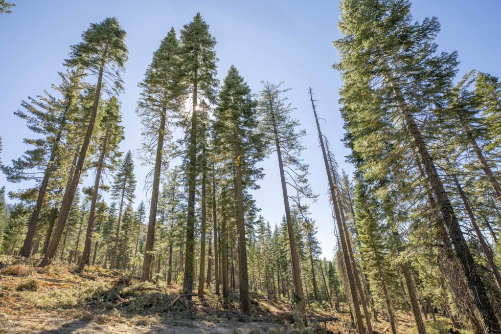
Accurate tracking of forest data is of increasing importance. If we do not proactively manage our forests, we may lose them to catastrophic fire or widespread die-off from drought and disease.
Unfortunately, “the State may be further behind than they realize [in reaching their 1 million acre goal] because of double counting across datasets and possible over-reporting in agency datasets,” (Knight et al. 2021), demonstrating the need for a clear account of how much progress has already been made.
To help land managers more accurately visualize the work left to be done, Dr. Clarke Knight, a postdoctoral researcher at the US Geological Survey, has teamed up with CECS scientists to create an integrated geospatial dataset that identifies the location and intensity of forest treatments from state and federal databases. Together they integrated the databases by standardizing the intensity of treatments by the amount of tree canopy loss visible from aerial or satellite imagery. Then, they applied a change detection (CCDC) algorithm to the integrated dataset, based on satellite remote sensing between 1984 and 2019 to track management events. The performance of the algorithm was verified using Collect Earth Online (a free, open-source tool for landscape monitoring) to identify disturbances from images in the National Agriculture Imagery Program and from disturbance areas identified by the change algorithm. They compared the algorithm to the archival state and federal datasets to create a refined management dataset with better information on the timing and spatial detail of management events in California. By comparing the algorithm to the archival datasets, CECS scientists were able to better assess the scale and intensity of current treatments and see which areas forest treatments may have been over- or under-reported (see Figure 1 below).
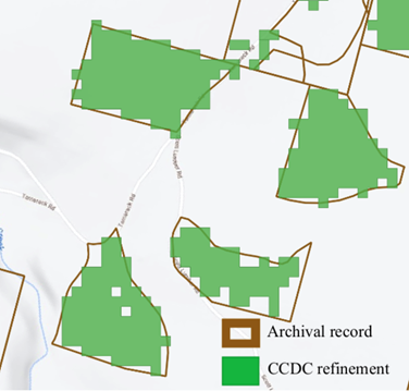
Figure 1. The treatment areas are median 5% smaller with CCDC refinement, showing the trend of over-reporting in archival records.
Utilizing this dataset created by Knight and CECS colleagues, state and federal agencies can work together more easily and effectively to meet their one million acre treatment goal. This new spatially explicit record of forest management will reduce over-reporting of treatment areas and help land managers focus on untreated acres. Because this record can be easily updated with remote sensing data, it has the potential to be the most up-to-date record of forest management for the state. The remote sensing record can also be used to estimate forest recovery after a large disturbance, such as fire or thinning, by showing us how the landscape changes over the time. Knowing the rate of recovery after treatment allows land managers to prescribe a more useful management frequency for forests.
By using remote sensing to improve archival datasets and provide more accurate guidance for management, land managers are better prepared to reduce risk of catastrophic wildfire and to evaluate ecosystem services, and to better protect our communities against the approaching effects of climate change.
View the full paper in the Journal of Environmental Management here.